




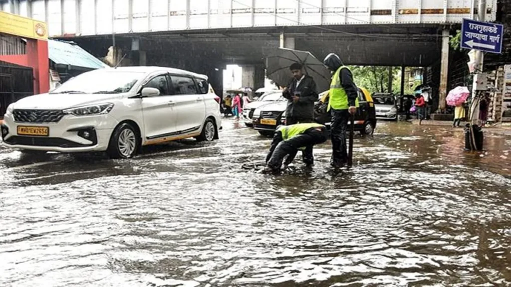
The active southwest monsoon has entered a fierce phase, unleashing widespread torrential downpours over multiple regions of the country. Dubbed as a full-scale monsoon fury, the India Meteorological Department (IMD) has issued a series of severe weather warnings. The latest All India Weather Forecast Bulletin indicates that multiple weather systems have converged, triggering intense rainfall activity across Northwest, Central, Northeast, and West Coast India.
As normal life faces staggering disruptions, municipal authorities and rescue teams are working around the clock to manage the initial fallout of this heavy rain across India.
The Current State of Southwest Monsoon 2026
The southwest monsoon has rapidly covered ground, advancing into the remaining pockets of Gujarat, along with extensive expansions over Rajasthan and Haryana. According to the IMD, meteorological dynamics remain highly favorable for the monsoon’s further push into the leftover boundaries of Northwest India over the coming 48 to 72 hours.
The current escalation is fueled by a potent mix of weather phenomena: a persistent monsoon trough hanging lower than its standard position and moisture feeds rushing in simultaneously from both the Arabian Sea and the Bay of Bengal. This atmospheric setup is actively converting massive maritime moisture into localized, intense cloud bursts. Consequently, the national cumulative rainfall deficit has rapidly shrunk down to 12%, thanks to this above-normal July wet spell.
Regional Breakdown: Where the Storm Hits Hardest
The IMD forecasts heavy rain across India with varying levels of severity. The weather department has categorized regional impacts to assist local disaster management groups.
Read Also: Maharashtra TET Paper Leak Bihar Connection: Assets Worth Crores Traced to Delhi & Patna
Extreme Risk Zones: Sub-Himalayan West Bengal, Sikkim, and the Northeast
The maximum threat level is concentrated over the eastern and northeastern corners of the country.
- Sub-Himalayan West Bengal & Sikkim: High risk for isolated extremely heavy rainfall that could trigger immediate flash floods in low-lying terrains.
- The Northeast Belt: Arunachal Pradesh, Assam, Meghalaya, Nagaland, Manipur, Mizoram, and Tripura are facing continuous heavy to very heavy spells. Rivers across these states are being closely monitored for swelling water levels.
Central and Western India: Gujarat and Madhya Pradesh Bracing for Impact
The western coastline and central plains continue to experience non-stop precipitation.
- The West Coast: The Konkan region, Goa, and Coastal Karnataka are under severe warnings. Extremely heavy isolated downpours are likely along these coastal belts.
- Inland Regions: The Gujarat region, Saurashtra, Kutch, Madhya Maharashtra, Vidarbha, and both East and West Madhya Pradesh are mapping out emergency responses as the active rain belt passes through.
Northwest India: Season’s First Intense Spells Trigger Delhi-NCR Deluge
Northwest India has transitioned into a highly active rain cycle due to an interacting western disturbance.
- Delhi-NCR: The national capital area witnessed its most widespread and intense rainfall of the season. Base stations like Najafgarh logged a staggering 84mm of rain in a single afternoon block, turning roads into urban streams.
- Adjoining Plains & Hills: Robust yellow and orange alerts cover Punjab, Haryana, Chandigarh, West Uttar Pradesh, and East Rajasthan.
Ground Reality: Infrastructure Cracks Under Torrential Downpours
The scale of this monsoon fury is visibly testing urban planning and highway infrastructure. Severe blockages and damages have surfaced over critical transit networks.
Delhi-NCR & Gurugram: NH-48 Cave-In and Corporate WFH Advisories
The first massive spell of the season brought the National Capital Region to an abrupt halt. In Gurugram’s Narsinghpur stretch, a major segment of the vital Delhi-Jaipur Highway (NH-48) caved in, forcing police to close off entire lanes. This structural failure triggered bumper-to-bumper traffic gridlocks spanning up to 10 kilometers, leaving commuters stranded for hours between Hero Honda Chowk and the Kherki Daula Toll Plaza.
Air travel felt the heat as well, with waterlogging and lightning causing mass delays for over 300 flights at Delhi’s IGI Airport, alongside structural route diversions. In response, Gurugram police issued emergency public advisories, urging corporate houses to mandate Work From Home (WFH) protocols to lower road density.
Uttarakhand: Mountain Highways Blocked by Landslides
Up north in the hill states, the situation is increasingly precarious. Torrential rains have triggered major mudslides and rockfalls across the rough terrain of Uttarakhand. Debris and massive boulders rolling down slopes have abruptly shut down traffic on the Yamunotri National Highway (NH-134) near Siyanchatti.
The State Emergency Operation Centre (SEOC) verified that more than 32 arterial and secondary roads have been completely blocked due to rain-induced debris. Structural clearance teams have deployed heavy machinery on-site, though non-stop rain continues to hamper immediate clearance missions.
IMD Safety Advisory & Travel Guidelines
As the IMD forecasts heavy rain across India to persist over the coming week, citizens are strictly advised to adhere to safety protocols:
- Pre-Travel Validation: Thoroughly check online traffic updates and local police advisories before mapping out commutes.
- Avoid Submerged Zones: Do not attempt to drive or wade through waterlogged subways, underpasses, or flooded streets.
- Infrastructure Distance: Stay completely clear of dilapidated or vulnerable structures, old trees, and open power lines.
- Hilly Terrain Warning: Avoid traveling to landslide-prone high altitude destinations in Uttarakhand, Himachal Pradesh, and Sikkim until weather systems normalize.
Frequently Asked Questions (FAQs)
1. What does the IMD mean by “extremely heavy rainfall”?
The India Meteorological Department classifies rainfall above 64.4 mm in a 24-hour period as heavy. If the recorded rainfall crosses 124.4 mm it is classified as very heavy, and anything exceeding 204.4 mm is marked as exceptionally or extremely heavy rainfall.
2. Is there a Work From Home (WFH) advisory for Delhi-NCR?
While the Delhi administration hasn’t passed a uniform order, the Gurugram police department has actively advised private companies and corporate offices to implement WFH options to safeguard employees and reduce traffic on broken sections like NH-48.
3. Which highways are currently affected by the monsoon rains?
The two major affected transit points are National Highway 48 (Delhi-Jaipur Highway) due to a massive road cave-in near Narsinghpur, and National Highway 134 (Yamunotri National Highway) in Uttarakhand due to heavy rockfalls near Siyanchatti.
4. How long is this intense monsoon spell expected to last?
According to the IMD bulletin issued on July 8, the active monsoon trough and supporting western disturbances are projected to keep rainfall widespread and heavy through to the upcoming weekend, with special focus on North and Central India.
Conclusion: An Active Monsoon Demands Maximum Vigilance
The unfolding monsoon fury across India serves as a stark reminder of the immense pressure that intense natural cycles exert on contemporary infrastructure. With the IMD forecasting continued heavy rain across major states, keeping an eye on official weather alerts, avoiding flooded vectors, and prioritizing safety over travel plans remains paramount. Stay tuned to localized weather bulletins to navigate through this severe seasonal peak safely.
For more information, follow Shabdsanchi‘s social media pages today and stay updated.
- Facebook: shabdsanchi
- Instagram: shabdsanchiofficial
- YouTube: @shabd_sanchi
- Twitter: shabdsanchi